30/March/2021
Archipelago is an electronic monitoring (EM) service provider based in Victoria, Canada, with offices across British Columbia, Australia, the United States, and Norway. EM represents about one third of our business, with at-sea observers, dockside monitoring, and environmental services making up the rest. Archipelago was established in 1978, and we pioneered EM in our BC fisheries starting in 1999 read more
The pilot project will test a newly developed, low-cost EM system in combination with a tablet-based electronic logbook (E-Log) to determine its effectiveness as a tool to improve data quality and the timeliness of in-season management decisions, specifically related to the spatial distribution of crab gear to mitigate marine mammal interactions.

The Australian Fisheries Management Authority regulates the nation’s pelagic longliners, and together with Archipelago Asia Pacific, has introduce a world-leading electronic monitoring system to keep watch on what these vessels catch and where they go. It’s all part of the management to protect both target and bycatch species in Australian waters.

During the summer of 2002, Archipelago worked with the International Pacific Halibut Commission to pilot test the option of using CCTV-based electronic monitoring equipment for monitoring seabird bycatch within the Alaska longline halibut fishery.

Seabird mortality resulting from interactions with the third-wire has been documented, but observers deployed to these vessels have other critical duties important to fisheries management and science that preclude a comprehensive assessment of this issue. Monitoring the third-wire on several types of trawl vessels is the critical component to evaluating the threat to short-tailed albatross....

A Catch Quota Project in England is tracking “total catch” at sea to help support responsible resource management within commercial fisheries. Rather than just counting the fish that make it to the dock, the Catch Quota Project equips each vessel with an electronic monitoring system to accurately account for all catch—including fish discarded at sea—and help fishermen verify quotas, eliminate waste, and encourage selective fishing practices.

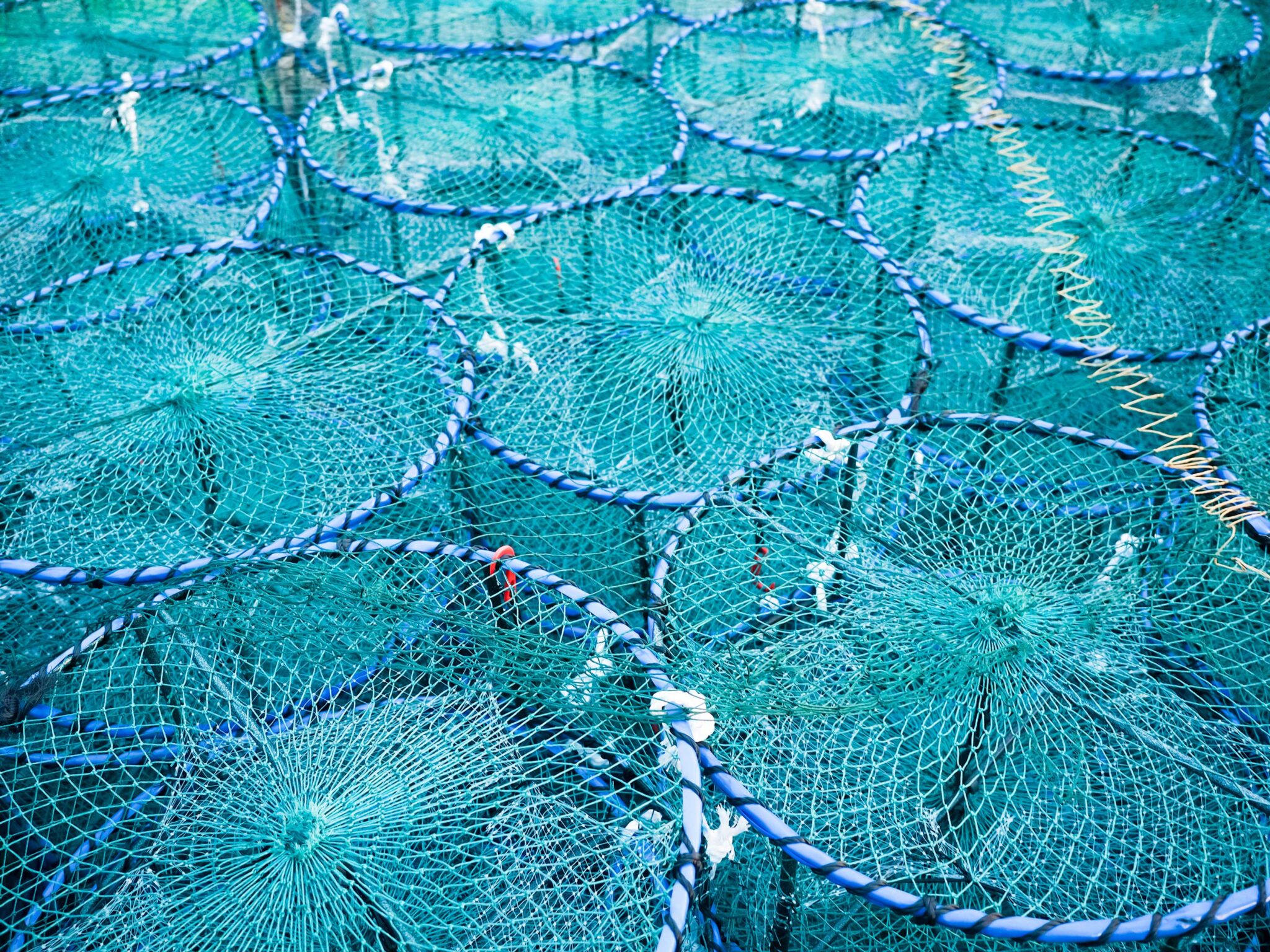
The Area ‘A’ crab fishery employed a fleet of about 50 vessels fishing for Dungeness crab in northern British Columbia. During the 1990s, the crab fishery intensified in terms of catch, the number of vessels involved and amount of trap gear deployed. Escalation of the fishery resulted in a dramatic increase in fishing effort with more than 50,000 traps being deployed.

In 2001, Archipelago updated an earlier compliance monitoring infrastructure at BC’s sablefish seamount fishery with an onboard electronic monitoring alternative. The new equipment allowed for rapid data processing and improved access to specific fishing activity imagery.

British Columbia’s salmon fisheries were the first to participate in the Canadian Department of Fisheries selective fishing initiatives. The Selective Fisheries Program was introduced as an industry-led initiative to reduce bycatch and promote selective fishing.

In 2011, Spanish purse seiner Playa de Bakio became the world’s first tropical tuna vessel to test the latest in electronic monitoring technology. Equipped with both a CCTV-based monitoring system and onboard observers, the test vessel enabled researchers to compare the advantages and challenges of each, and to ultimately determine whether an automated monitoring system could serve as a viable alternative to onboard observers.

The US West Coast mid-water trawl fishery for Pacific whiting has adopted EM to help manage quotas, reduce discards, and control costs. Introduced as an automated alternative to onboard observers more than a decade ago ...

To help ensure the long-term sustainability of British Columbia’s groundfish fishery, Fisheries and Oceans Canada worked with Archipelago to introduce an at-sea monitoring program that would accurately assess at-sea fishing activity across the entire fishery.

As part of its groundfish dockside monitoring programs, Archipelago works with fisheries staff to establish data–management standards, while providing trained and government certified shore–based observers to assist with fisheries data collection, species identification, and the integration of new technologies

Archipelago has trained and provided certified at-sea observers for domestic and international vessels since 1985. Through its groundfish at-sea observer program, the company provides 100% at-sea monitoring services for all groundfish fisheries—including international vessels—fishing within Canada’s Pacific Region zone.

Archipelago supports catch and shellfish dockside monitoring programs for a range of British Columbia fisheries, including the BC geoduck and shrimp fisheries.

The salmon catch reporting program would require salmon fishers to record their retained catch, at-sea releases, times and locations for all fishing activities. In addition to recording all catch data in a Department of Fisheries salmon logbook, fishers would also report their catch and release information by telephone immediately following each opening.

A group of Sitka and Homer longliners hope to demonstrate this season that electronic monitoring can collect most of the data needed for managing the hook and line fisheries. The pilot project is part of an ongoing effort by the Alaska Longline Fishermen’s Association and other longline groups to integrate electronic monitoring as an alternative to having observers aboard boats that longline for sablefish and halibut.

Archipelago provides technical support and leadership for government and industry scientific research cruises. Archipelago provides technical support and leadership for government and industry scientific research charters. Archipelago scientific research charters typically involve a high level of sampling and catch documentation, as well as extensive data management. Examples include stock assessment, monitoring, tagging, sampling and more.

In 2002, a small-scale demonstration fishery set out to explore individual quota allocation as an alternative management approach in the salmon troll fishery. Archipelago was contracted by the Area H Gulf Troller’s Association to provide a comprehensive salmon troll monitoring program, collecting information needed to evaluate the potential of this alternative fishery management method.
06/May/2021
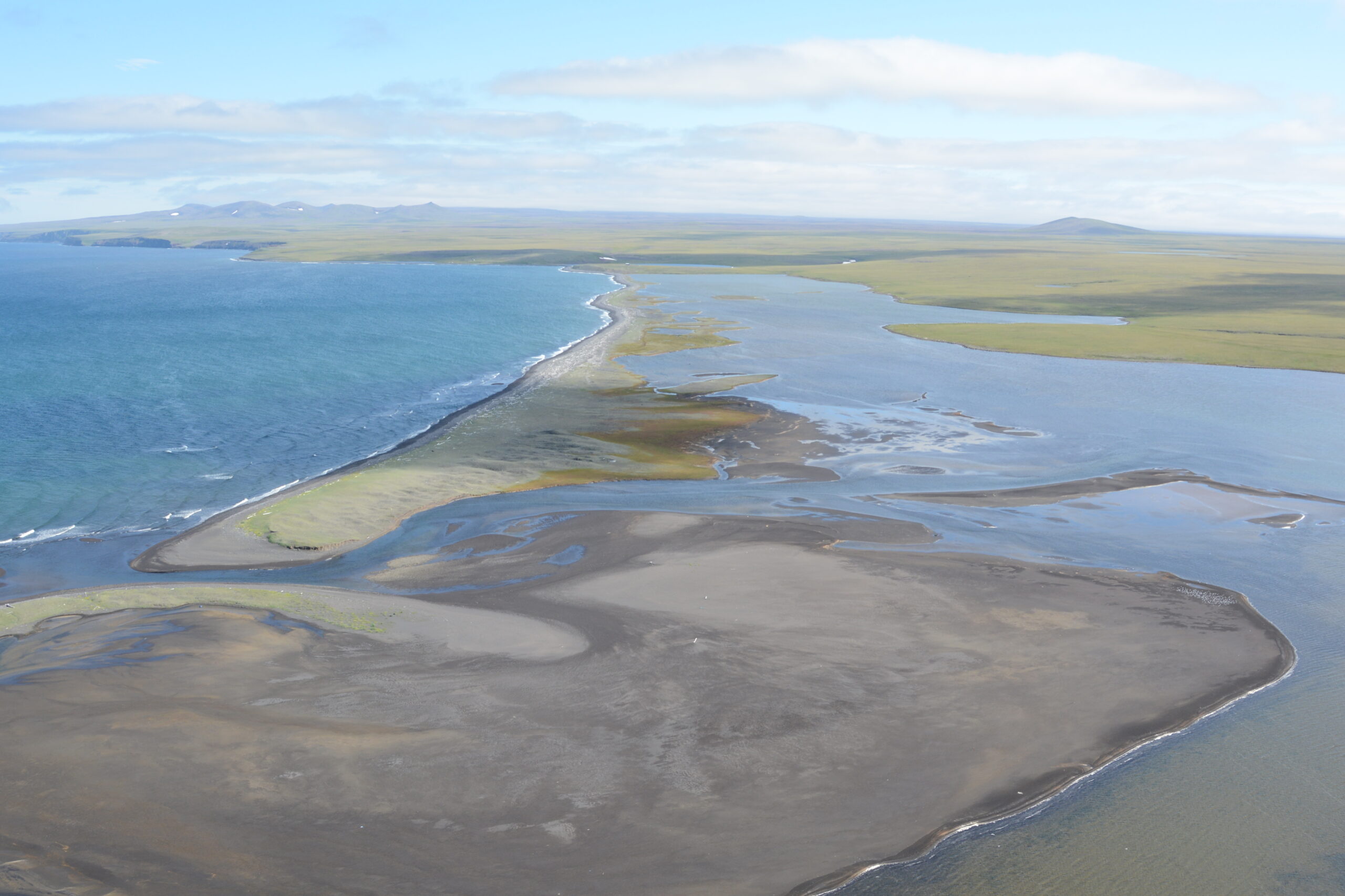
A coastal habitat mapping system which has been done for the whole coast of the Pacific Northwest. ShoreZone started flying in BC and then moved on to Alaska (Washington and Oregon coastlines have been flown as well) to fly dozens of surveys over the years, collecting low tide imagery to use for classification into descriptive, biophysical spatial dataset. One of the most remote places in Alaska that was surveyed for ShoreZone is Saint Lawrence Island, over 100 kilometres off the coast of Nome Alaska in the north Bering Sea. The survey there was done during summertime low tides, in one week in the middle of July 2013. read more

Between 1999 and 2007, Archipelago was involved in identifying marine significant areas (MSAs) throughout British Columbia. A framework concept was identified from which Archipelago could develop a planning and decision support tool to assist in the identification and mapping of MSAs.

When the City of Victoria moved to halt seawall erosion and re-nourish the beach along the historic Ross Bay waterfront, Archipelago joined the project to help minimize any impact from construction, and assess the restoration of habitat above and below the tide line over the long term.

When preparing to build a liquefied natural gas (LNG) export facility at Bish Cove, near Kitimat, British Columbia, Chevron Canada and Apache Canada initiated a Biodiversity Monitoring and Assessment Program (BMAP) to gather information about the status and trends of habitats, ecosystems and species at that location before, during and after construction.

In 2014, Archipelago provided an environmental assessment for the marine component of a proposed natural gas transmission system planned for the northwest coast of British Columbia.

Archipelago examined the unique challenges involved in providing an effective oil spill response within BC’s coastal and estuarine wetlands. Although the risk of oil spills impacting British Columbia’s coastal marshes has been increasing (due in part to increased marine traffic), the assessment of oil spill impacts and treatment options for British Columbia’s coastal wetlands has largely been based upon knowledge of oil spills in wetlands outside of BC.

As part of a biodiversity monitoring and assessment project near the site of a proposed liquefied natural gas export facility, Archipelago introduced a plan to monitor the health of nearby eelgrass communities over time. When preparing to build a liquefied natural gas (LNG) export facility at Bish Cove, near Kitimat, British Columbia, Chevron Canada and Apache Canada initiated a Biodiversity Monitoring and Assessment Program (BMAP) to gather information about the status and trends of habitats, ecosystems and species at that location before, during and after construction.

With a natural habitat bank planned for Greater Victoria’s Esquimalt Harbour, Archipelago in partnership with SNC Lavalin—was contracted by the Department of National Defence (CFB Esquimalt) to facilitate the project from an environmental perspective. This involved identifying the best locations for three rocky reefs, creating a design for each of the structures, and monitoring the construction and colonization of the new reefs.

From 2007 to 2008, Archipelago provided key input on the design and implementation for shoreline rehabilitation on the Dockside Green development, and the adjacent Point Ellice Park waterfront.

When preparing to build a liquefied natural gas (LNG) export facility near Kitimat, British Columbia, Chevron Canada worked with Archipelago to implement a long term marine monitoring program. In 2012, Chevron Canada and Apache Canada announced a joint venture to build and operate a liquefied natural gas (LNG) export facility at Bish Cove, near the Port of Kitimat, British Columbia.

To limit the ecological impacts of the Deltaport Third Berth terminal expansion project, Port Metro Vancouver developed a Habitat Compensation Plan that stipulated the construction of compensatory habitats to accommodate nearby fish and eelgrass communities.