ShoreZone
A coastal habitat inventory that combines low-tide aerial imagery with GIS shoreline data to support environmental planning, spill response, and resource management across the Pacific coast from Oregon to Alaska and now extending into Atlantic Canada.
What ShoreZone Is
ShoreZone is an imaging and habitat classification system for the coastal nearshore margin including the shallow subtidal, intertidal shoreline and supratidal fringe. One objective of ShoreZone is to produce a georeferenced, searchable inventory of the physical and biological attributes of coastal habitats. Dozens of partners are making millions of photos, video clips, maps, and habitat records available to the public online for free.
A standardized record of the shoreline
Consistent classifications from Oregon to the Arctic in the Pacific Region and New Brunswick to Newfoundland in the Atlantic Region.
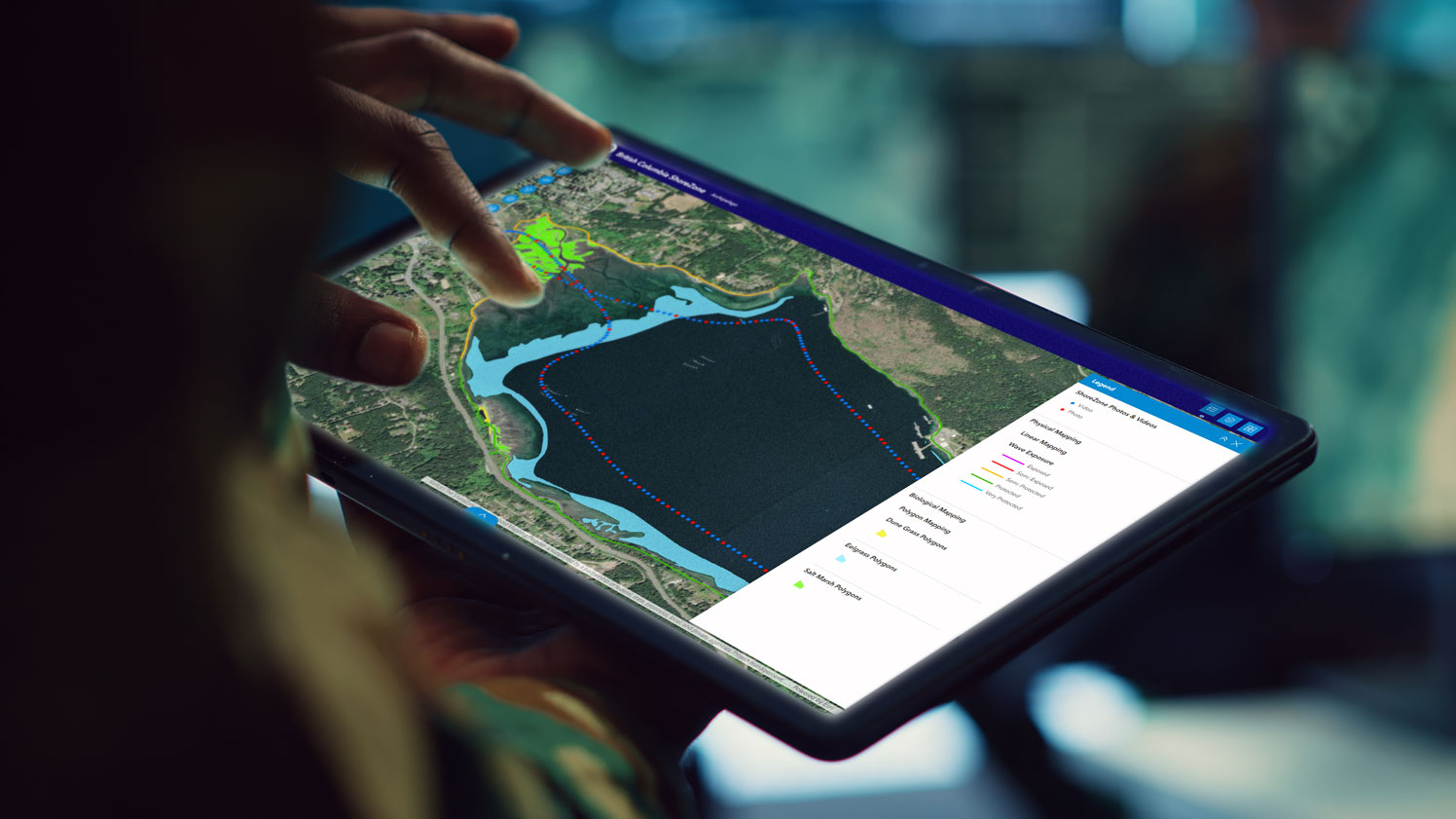
ShoreZone describes coastal habitats using spatially explicit attributes visualized in a GIS platform. Because the imaging and mapping protocols are standardized, datasets from different regions and different survey years can be combined into a continuous picture of the coast.
- Physical and biological shoreline attributes mapped to a common standard
- Spatially explicit data ready for GIS analysis
- Nearly continuous coverage throughout the Pacific Region, now extending into the Atlantic Region
The coast at low tide, captured from above
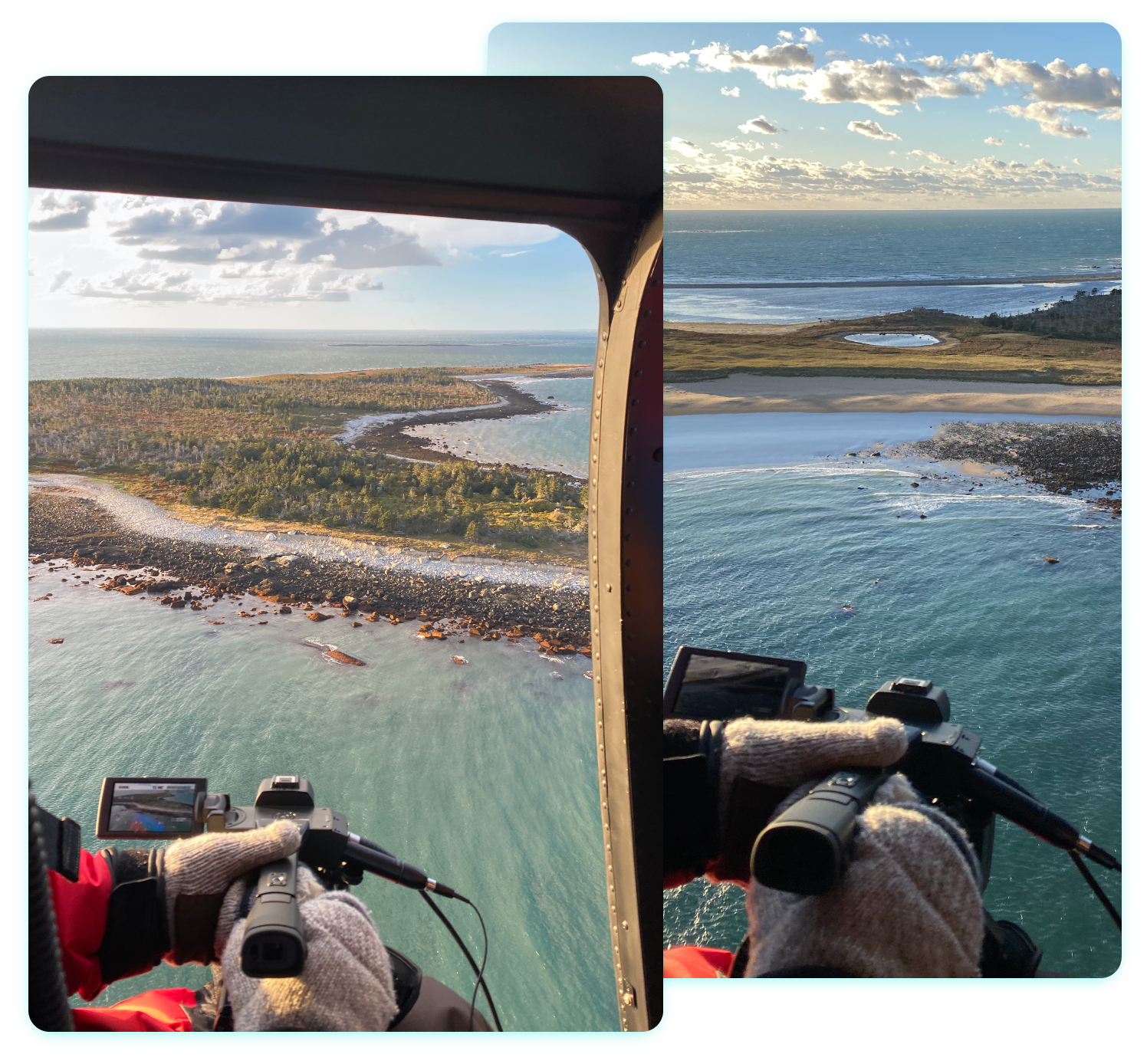
Oblique aerial video and high definition still photographs taken at the low tide.
ShoreZone imagery is collected at low tide from helicopters and tied to a GPS trackline. The library spans several decades, with early surveys on video tape and 35 mm slide film and more recent work in high-resolution digital video and still photography.
- High-resolution oblique aerial video of the shoreline
- Still photographs that augment the video record
- Imagery linked directly to mapped habitat units
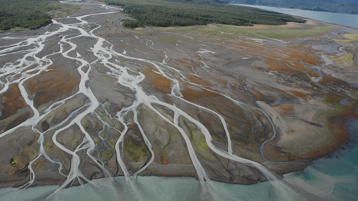
Shoreline Geomorphology and Biota, described together
Geomorphologists and biologists interpret every shoreline segment.
During each survey, coastal geomorphologists and biologists describe the intertidal geomorphology and biology as they fly the shoreline. The narration is synchronized with the imagery, enabling mappers to classify both shoreline physical characteristics and biological communities, from substrate composition to intertidal, supratidal and subtidal biological assemblages (biobands).
- Physical habitat attributes such as substrate, slope, and shore type
- Biological bands, including algae, eelgrass, and coastal vegetation
- Expert narration captured alongside the imagery
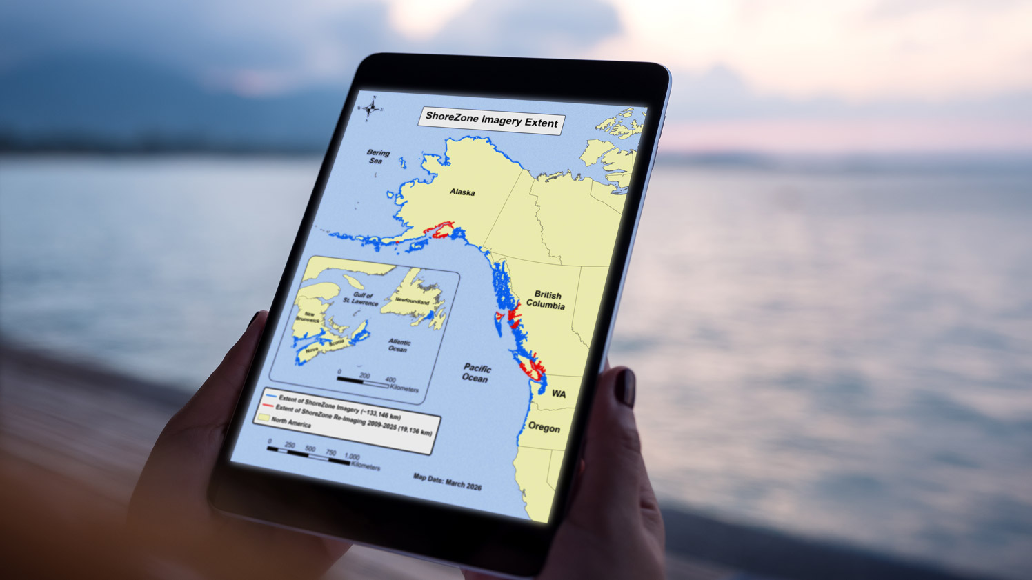
From Coast to Coast
From Oregon to the Arctic in the Pacific and New Brunswick to Newfoundland in the Atlantic.
ShoreZone’s exceptional spatial reach is achieved through the integration of numerous aerial surveys and shoreline mapping efforts into a standardized, region-wide dataset. This approach has resulted in complete coverage of Oregon, Washington, and British Columbia, and more than 90% coverage of Alaska, with data acquisition continuing in the remaining areas, such as Atlantic Canada.
- Complete coverage of Oregon, Washington, and British Columbia
- More than ninety percent of Alaska mapped
- Recent ongoing coverage of New Brunswick, Nova Scotia and Newfoundland
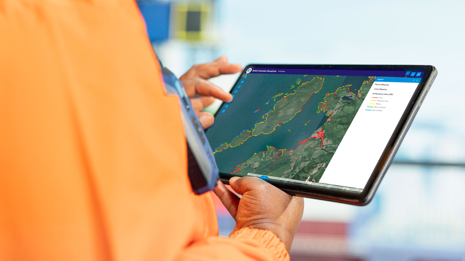
Explore the coast for yourself.
This short walkthrough covers the basics of the ShoreZone viewer. Search to any stretch of coastline by name or coordinates, play the captured footage to move along the shore, and open high-resolution stills wherever you want a closer look. Any image can be saved straight to your computer.
Who Uses ShoreZone, and How
The ShoreZone mapping system provides a decision support tool with many potential uses including community planning, conservation planning, research and fisheries management, emergency planning and response, search and rescue, education, habitat modeling and people who want to explore the coast from home.
Ready before a spill happens
Baseline habitat data for faster, smarter response.
Response planners use ShoreZone to identify which shorelines are most sensitive and how to prioritize protection and cleanup. The data feeds regional response tools and helps teams prepare for spills, coastal debris cleanup, and search and rescue operations.
- Shoreline sensitivity context for spill preparedness
- Inputs for regional response and training tools
- Support for coastal debris and search-and-rescue planning
Plan with the whole coast in view
Habitat classification for science and planning.
Managers and scientists use ShoreZone for habitat classification, coastal use planning, and natural resource management. It has supported estuarine classification, blue carbon mapping, national park case studies, and coastal planning with Indigenous and local communities.
- Habitat and estuarine classification
- Coastal use and conservation planning
- Inputs for blue carbon and ecosystem studies
A teaching record of the coast
From classrooms to cultural and archaeological work.
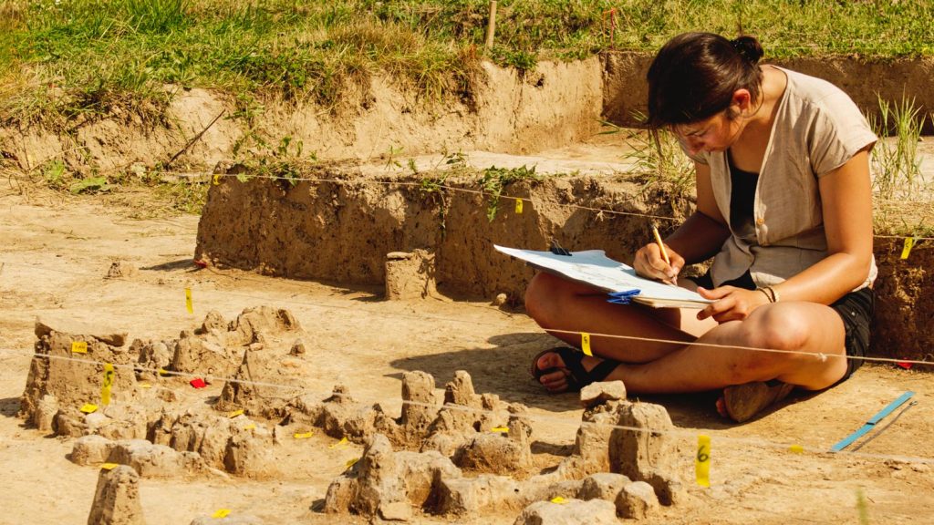
Educators use ShoreZone imagery and data to bring the coast into the classroom. The dataset has also supported archaeological investigation and the study of traditional gathering patterns tied to coastal geomorphology.
- Classroom and digital storytelling resources
- Support for archaeological investigation
- Context for traditional and cultural coastal use
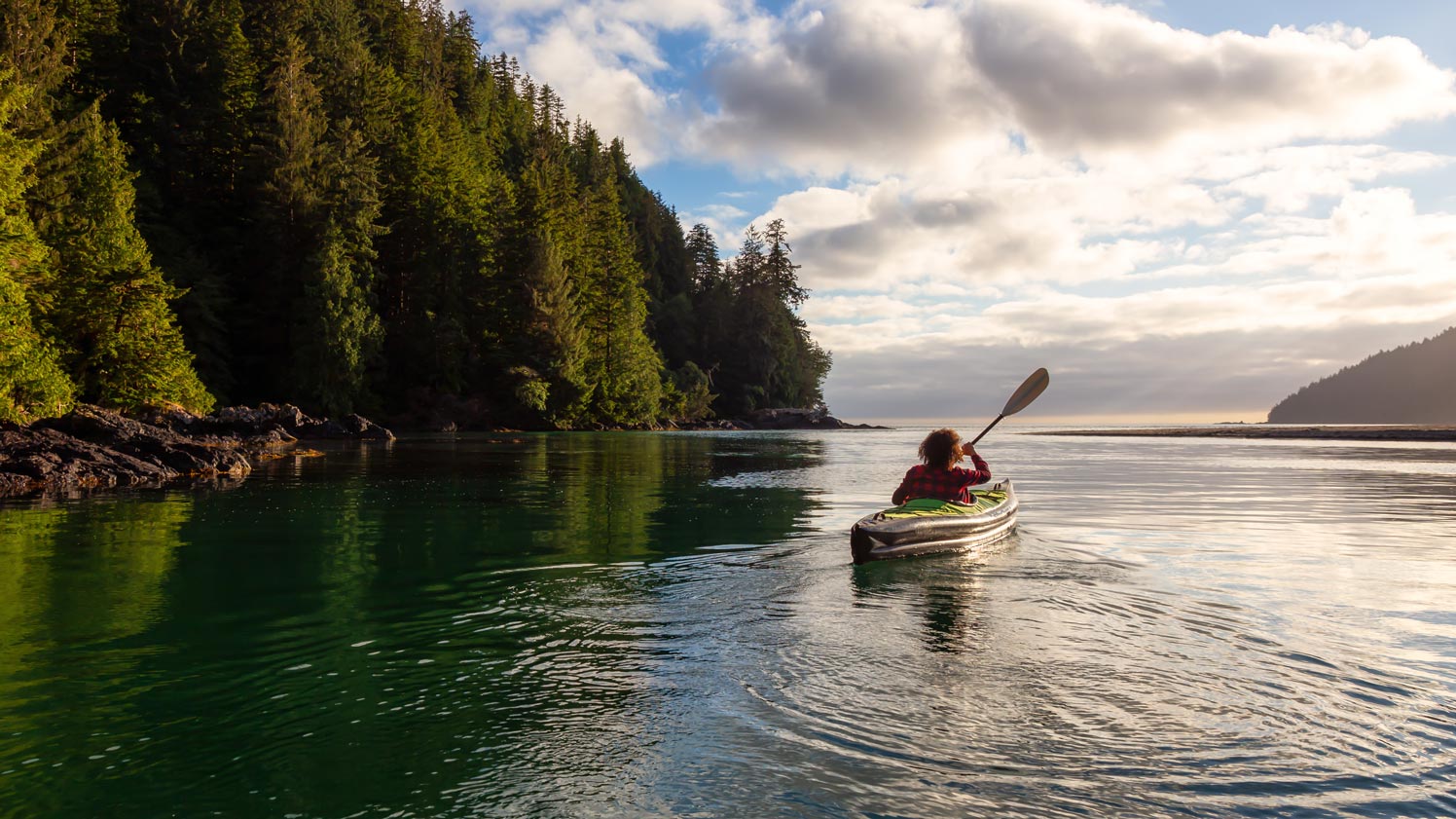
Know the shore before you go
Plan routes and landings from home.
Boaters, kayakers, and other coastal travelers use ShoreZone to choose routes and resting places. The full library is free and public, so you can explore the shoreline in detail before you leave the dock.
- Route and landing planning
- Detailed shoreline imagery for trip preparation
- Public, free access to the full library