A coastal habitat mapping system which has been done for the whole coast of the Pacific Northwest. ShoreZone started flying in BC and then moved on to Alaska (Washington and Oregon coastlines have been flown as well) to fly dozens of surveys over the years, collecting low tide imagery to use for classification into descriptive, biophysical spatial dataset.
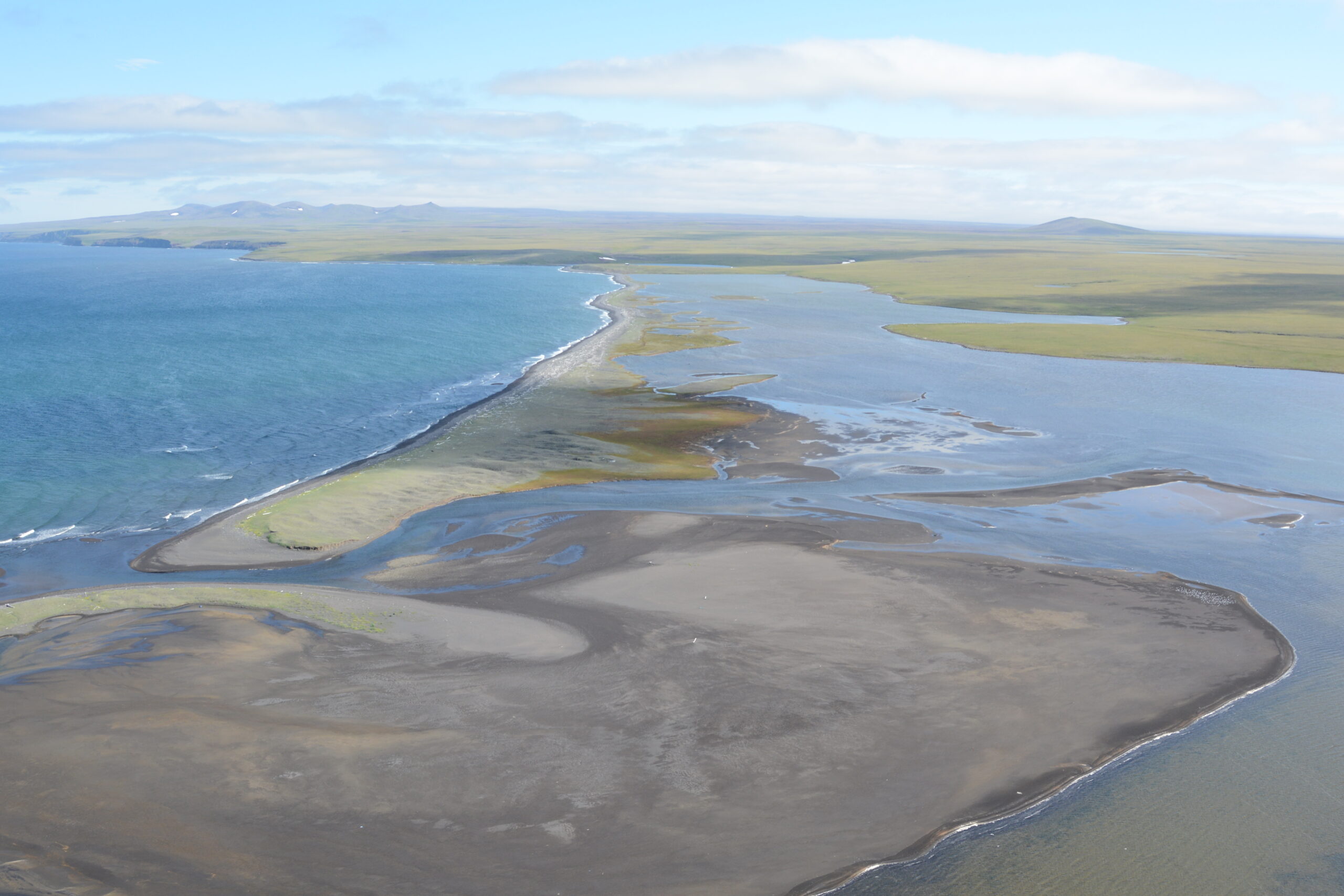
One of the most remote places in Alaska that was surveyed for ShoreZone is Saint Lawrence Island, over 100 kilometres off the coast of Nome Alaska in the north Bering Sea. The survey there was done during summertime low tides, in one week in the middle of July 2013.