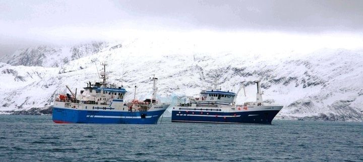
For fisheries operating near the South Georgia Island wildlife sanctuary, protection of endangered seabirds is a top priority. Tori lines and streamers help keep birds safe, and observers and monitoring systems verify results. Since 2014, Archipelago has been working alongside the Argos Froyanes fishing company to record and review tori line procedures and ensure the region’s strict seabird conservation regulations are being met.
Located 1,400 km East Southeast of the Falkland Islands, the sub-Antarctic Island of South Georgia is home to a vast number of rare and endangered seabirds (including several species of albatross) living amidst the region’s prime fishing grounds.
To help avoid interactions between seabirds and longline fishing vessels, the Commission for the Conservation of Antarctic Marine Living Resources (CCAMLR) oversees a comprehensive set of seabird conservation measures designed to reduce fishing–related seabird mortality.
Implemented and enforced by the Government of South Georgia and the South Sandwich Islands (GSGSSI), these measures require longline fishers to attach weights to branch lines, set gear only at night (under minimal lighting), and deploy tori lines equipped with colorful streamers to help scare birds away from baited hooks.
In 2014, the Argos Froyanes Ltd. fishing company approached Archipelago to explore monitoring alternatives for longline fishing vessels operating in the South Georgia Patagonian Toothfish fishery. Argos’ interest in Archipelago electronic monitoring (EM) systems stemmed from a 2014 MRAG report that described similar Archipelago applications used to monitor bycatch reduction programs within fisheries governed by the Australian Fisheries Management Authority (AFMA) and New Zealand Ministry of Fisheries.
For the South Georgia project, Archipelago installed EM Observe™ monitoring systems aboard two Argos vessels: the F/V Argos Georgia and the F/V Argos Froyanes.

Each EM system included a control center, user interface, a pair of rotation sensors (one to detect gear setting and the other to detect hauling), a GPS receiver, a satellite modem, and two cameras (one to capture setting and the other to capture hauling). To comply with the CCAMLR requirement to minimize external illumination, infrared (IR) cameras were a necessity.
The EM systems were installed in March 2014, and configured to collect data throughout the 2014/2015 South Georgia Toothfish fishery seasons. As the electronic monitoring system was not intended to replace human observers in this case, fisheries observers were present on each vessel as well.
During this initial two–year trial, Argos stakeholders had the opportunity to learn more about the systems with remote support from Archipelago staff. Various challenges were identified and resolved through fine tuning, crew training, and ongoing collaboration between Argos and Archipelago.
Due to the requirement to set gear at night (using minimal lighting), IR cameras were required; however, IR cameras alone were not sufficient for recording setting activity at the distances required.
While the standard IR cameras could record nighttime activity out to a distance of approximately five to ten metres, the setting operations extended to a range of 80 metres or more. To accommodate these distant viewing areas, EM technicians specified an external IR illuminator for each location.

Based on the promising results of this initial trial, Argos identified two factors as the ongoing focus for this EM project to follow:
Following the successful conclusion of the initial two–year test period, Argos and Archipelago continue to refine and develop the fishery’s electronic monitoring program.
Next steps include a further integration and refinement of the way infrared video is used to better verify tori line deployments. (Pending approval from the GSGSSI, protocols could be implemented to allow observer access to EM data, and appropriate data tracking and chain–of–custody protocols developed to support the use of EM data as proof of compliance with seabird mitigation measures.)
As a dedicated supporter of sustainable fishing practices, Argos is playing a key role towards the protection of seabirds within this unique and environmentally sensitive region.
For more information on the conservation measures described here, visit the Commission for the Conservation of Antarctic Marine Living Resources web site.
To learn more about the monitoring and review technology, visit the Electronic Monitoring page on this site.
The US West Coast mid-water trawl fishery for Pacific whiting has adopted electronic monitoring to help manage quotas, reduce discards, and control costs. Introduced as an automated alternative to onboard observers more than a decade ago, this monitoring initiative is helping to ensure the long-term livelihood of local fishermen, while setting a global benchmark for responsible fishing practices around the world.
The US whiting fishery is a high–volume midwater trawl fishery operating off the coasts of Washington, Oregon and northern California. The fishery has three sectors: catcher vessels delivering to shore–based seafood processors, catcher vessels delivering to at–sea mothership processors, and catcher processors that catch and process fish onboard the same vessel. Thirty–seven catcher vessels are endorsed to participate in the shoreside and mothership sectors.
To ensure a sustainable future for this resource, the fishery is regulated by an annual quota for total allowable catch. Although the fishery initially assessed total removals by monitoring catch offloaded at the dock, this method was later revised to account for all catch, including fish discarded at sea. This requirement led to a prohibition of at–sea discards, along with a fleet–wide program to monitor and verify—at sea—each vessel’s compliance with the fishery’s catch-retention regulations.
However, the realities of monitoring and verifying compliance at sea posed a challenge. For the shoreside fishery, the requirement of running many short fishing trips of less than a day, often departing with little notice, made onboard human observations a challenge. To accommodate the unique logistical requirements of this fishery, an automated electronic monitoring system was identified as an appropriate alternative.
To further explore and develop this initiative, the National Marine Fisheries Service, Northwest Fisheries Science Center contracted Archipelago. From 2004 to 2010, Archipelago designed, developed, and managed a program to monitor the shore–based component of the fishery using electronic monitoring (EM) data to achieve several goals:
As part of 2004–2010 EM program, participating vessels were equipped with an onboard electronic monitoring system that was configured to operate continuously while the vessel was at sea. Each system consisted of up to four video cameras, fishing gear sensors (on the winch drum and hydraulic lines), and a GPS receiver, all monitored by a control center and data logger installed on the bridge.
Archipelago technicians were available at landing ports to service EM systems, and retrieve hard drives as necessary. All EM data were provided to Archipelago for analysis, and results were reported to both the National Marine Fisheries Service and the fishing industry on a regular basis.
Annual reports were compiled for each fishery year, and a summary report produced to document the entire program. (See “Electronic Monitoring in the Shore-side Hake Fishery 2004–2010” ).
The program was funded primarily by industry at an average cost of ~$180 per sea day (with variances based on such factors as equipment requirements and the duration of each fishing season). This cost could have been reduced if fishers had chosen to purchase their EM systems and install them permanently; however, most initially opted to lease and install their EM systems annually—an artifact of the year–to–year uncertainty of this trial program.
By the program’s conclusion in 2010, participants had witnessed significant improvements. Sensor and image data had successfully profiled over 96% of fishery activity for most years. Success rates for data collection were highest in the final years of the program, with 99.0% (2009) and 98.7% (2010) of all video data recorded successfully.
EM was found to provide the same or better data quality as an onboard observer in recording the times and locations of each haul, and in confirming retention of all catch (although the wide–angle camera views used in this early application had in some cases limited the ability to identify individual species).
While operating under the EM program, participants had reduced discard quantities by 90%, to levels less than 0.3% of the total allowable catch (with the remaining incidences limited to occasional “operational” events).
Comparisons between the monitoring data and the logbook data showed strong agreement in event reporting (89%) and significant correlation in discard quantities. The quality of most (90%) of the EM data gathered was classified as either “medium” or “good”; overall the program was determined to be effective at documenting and characterizing discard activity (i.e. quantity, method, and reason for discarding).
Through the ongoing commitment of the fishermen and the whiting fishery project team, information obtained from the EM program has helped to drive change throughout the fishery; increasing the quality of catch data, decreasing the quantity of discards, and improving sustainable fishing practices overall.

Although widely considered to be a success, the seven–year EM program was discontinued in 2011 when the groundfish IFQ catch share quota system was implemented along with a requirement for 100% observer–based monitoring of the entire groundfish fleet. Initially, NMFS funded a large portion of the observer program, but this subsidy has declined annually, and is projected to end in 2016. (As of 2015, the cost of human observers was averaging approximately $500 per day).
In an effort to enable more cost–effective monitoring, the whiting industry began making requests to NMFS and the Pacific Fishery Management Council to restore electronic monitoring within the fleet. In September 2014, PFMC approved an application for an experimental fishing permit (EFP) for the whiting fleet. The EFP provides for a two–year trial EM program with the at–sea and shore–based whiting sectors. Participation in the program is voluntary, with vessels carrying EM systems to be exempt from the 100% observer requirement. As a pioneer of EM technology and the company that developed and led the 2004 to 2010 whiting EM program, Archipelago was selected to lead this new initiative.
Today Archipelago is working closely with the United Catcher Boats and the Midwater Trawlers Cooperative to provide a cost–effective monitoring program that will inform federal regulations, and support EM as a viable monitoring alternative for this fishery in the near future.
To help ensure the long-term sustainability of British Columbia’s groundfish fishery, Fisheries and Oceans Canada worked with Archipelago to introduce an at-sea monitoring program that would accurately assess at-sea fishing activity across the entire fishery.
Launched in 2006 by Fisheries and Oceans Canada in cooperation with Archipelago,, the British Columbia Groundfish Hook and Line / Trap Catch Monitoring Program (GHLCMP) is a primarily industry-funded initiative designed to ensure the long-term sustainability of BC’s groundfish resource.
To help enforce responsible fisheries management practices and support informed decision making, GHLCMP participants worked with Archipelago to equip their vessels with CCTV-based electronic monitoring (EM) technology.
With this equipment in place, participating vessels could automatically contribute valuable species-specific catch data that would help improve the accuracy of fisheries resource assessments within each sector.
Although introduced in 2006, the GHLCMP is the product of a cooperative effort that started years earlier. With conservation concerns increasing around the world, British Columbia’s groundfish fisheries had come under pressure to increase the scope of its catch-reporting processes.
Although existing dockside monitoring programs could account for 100% of landed catch, the lack of a comprehensive at-sea monitoring component created uncertainty about total catch primarily due to unknown at-sea releases.
In 2003, Fisheries and Oceans Canada initiated discussions with the commercial groundfish sector to address the growing conservation and sustainability issues. Fisheries and Oceans Canada established five principles to guide the development of a new management plan:
Subsequent discussions with fishing industry representatives resulted in the development of the Groundfish Hook and Line / Trap Catch Monitoring Program (GHLCMP). Designed to address each of Fisheries and Oceans Canada’s principles, while considering the financial and logistical realities, the GHLCMP identified a range of requirements:

Working closely with Fisheries and Oceans Canada and industry, Archipelago designed and implemented a cost-effective monitoring program for the fishery that addressed the above requirements.
A key aspect of the GHLCMP is the use of EM technology to audit self-reported data provided in vessel fishing logbooks. (The methodology and results are summarized in the article “The advantages of an audit over a census approach to the review of video imagery in fishery monitoring,” Stanley, R. D. et al., 2011).
Today, 100 percent of British Columbia’s commercial hook and line and trap groundfish fishing is monitored using Archipelago EM technology, involving approximately 200 vessels, 1,200 trips, 10,000 sea days, and 20,000 fishing events annually.
Since its inception in 2006, this program has clearly demonstrated how electronic monitoring can effectively address a variety of monitoring issues, including catch identification, enumeration and disposition, size determination, as well as time and area restrictions.
As a model of sustainable marine resource management, British Columbia’s EM programs are widely considered to be among the most progressive and effective anywhere. Each year, visitors come from around the world to study BC’s monitoring programs, and to identify strategies that they can implement within their own countries.
For more on the GHLCMP, see the “Evaluation of the Commercial Groundfish Integration Pilot Program” (pdf) produced by Fisheries and Oceans Canada (2009)
For the latest information on the Pacific Halibut fishery, see the Fisheries and Ocean’s Canada sustainability resource.